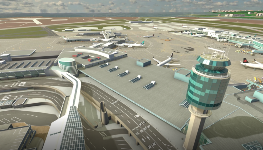
New ways of infusing aviation’s massive resource of data into the industry continue to emerge, while ever-improving processing, storage, and predictive technologies have given rise to fully digital twin versions of turbofan engines, commercial and military aircraft — and now airports. Howard Slutsken looks into the progress digital twinning is making at Vancouver’s airport.
Strolling through the newest section of the international terminal at Vancouver International Airport (YVR), Lynette DuJohn doesn’t have to worry about spilling her morning tea. She’s comfortably sitting at her desk, using a 3D model of YVR’s digital twin platform to explore the terminal.
DuJohn is vice president of innovation and chief information officer for the sprawling airport — Canada’s west coast airline hub, located on the traditional lands of the Musqueam Indian Band.
It’s early days for the airport’s digital twin, and DuJohn and her team are exploring ways to utilize the terabytes of data in the platform that found its genesis in YVR’s Innovation Hub.
“We had a solid business intelligence practice that’s been going on for years at YVR, that we called the data hub. Now, with the digital twin, we’re in a position to leverage it much more,” she tells us.
“Basically, it’s replicating the airport. Our digital twin isn’t just one thing. We have a two-dimensional and a three-dimensional model, and we’re using historical and real-time data to present key information to enable data-driven decision making and collaboration — which has never been available before.”
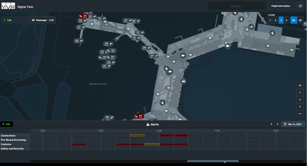
The 2D model is a fusion of a highly detailed map of the terminals with real-time data feeds, enabling the airport to see early benefits including pre-board security wait times, flight and aircraft position with detailed passenger data, and flow and waits for customs and immigration. There’s also a test in place with an AI-enabled camera system that gives an alert when a vehicle has been sitting too long in the terminal’s drop-off lane.
Maintenance issues throughout the terminal can be layered on the 2D model, and YVR’s team can respond by accessing the information via modules in the digital twin platform on iOS devices or desktop computers.
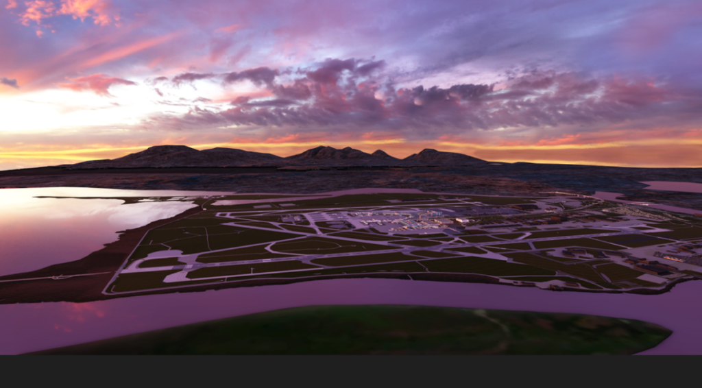
The fidelity of the platform is at centimetre resolution. The exterior data, including runways, taxiways, buildings and the surrounding Fraser River were captured from a helicopter outfitted with five high-definition cameras and a laser-based Light Detection and Ranging (LiDAR) system.
“Then we took the same equipment and we put it on a car, and we did everything at the ground level, and then we put it on a cart and captured the inside of the terminal,” says DuJohn.
She explains that it took a few weeks to record the data, and about six months to process the first renderings of the airport and terminals.
While the 2D module combines real-time sensor data with planning data and statistics into an impressive, operational situational awareness tool, it’s the 3D module that truly brings YVR to life.
In this hyper-realistic digital representation of the YVR environment, everything is reproduced — signage, carpets, garbage cans, taxiways, aircraft — everything, right down to the runway lights.
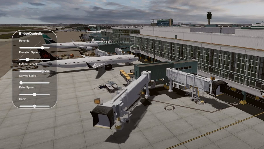
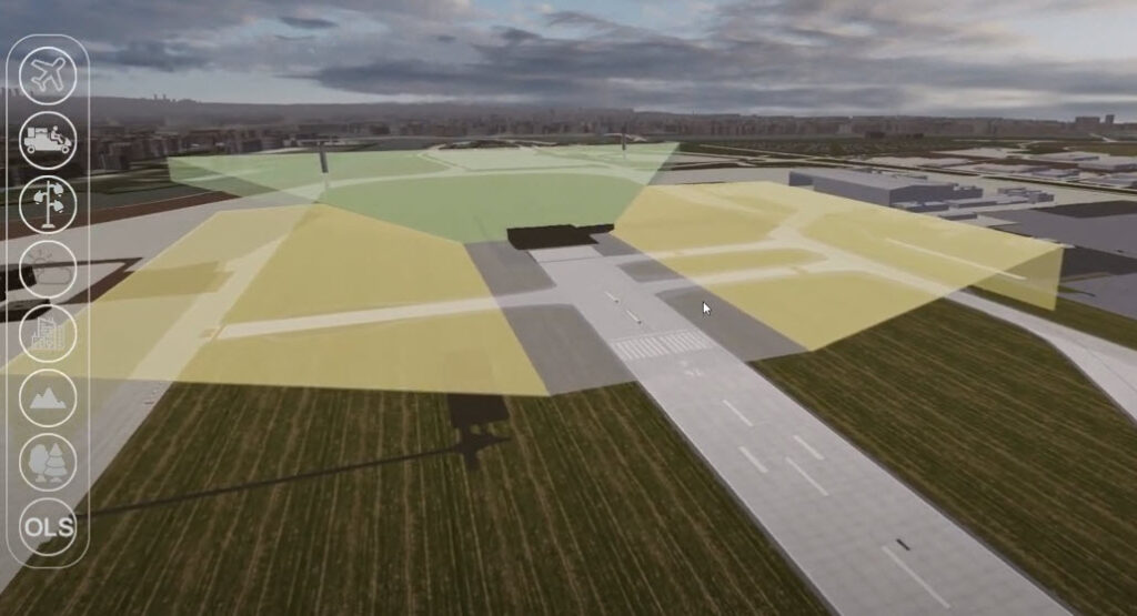
And the elements of the 3D model can be manipulated to simulate training and operational scenarios: a new aircraft type positioned at a gate to check for fit, prospective ramp workers tested on their airside driving skills, employees trained on the operation of aircraft bridges, or airside obstacle limitations can be checked with the addition of a simulated construction crane or structure. The model can also be populated with avatars, so that a full emergency evacuation of a terminal can be simulated.
Augmenting YVR’s Roadmap to Net Zero Carbon 2030, the team is using greenhouse gas emission simulations that draw real-world data from aircraft engine specifications. The airport hopes to show its airline partners how operational changes — such as gate locations or single-engine taxiing — could influence sustainability at YVR.
Next up for the YVR team is the integration of the real-time sensor and planning information in the 2D model with the 3D model — with accurate planes, passenger avatars, and even parked cars.
“The power of the twin is the actual visceral experience of the data. It’s making it all come to life,” says DuJohn. “What excites me is having these new tools to explore, test, trial and be immersed, and to make a difference in our community and our passengers’ airport experience.”
Author: Howard Slutsken
Published 20th October 2022


